Last year, I hiked the Pennine Way, a long-distance UK National Trail that I’d wanted to do for years. It’s a 268-mile challenging route through the Pennines from the Peak District to the borders of Scotland. It was tough, however, after completing it I immediately said I wanted to do it again!
Completing a long-distance hike like the Pennine Way is a magical experience. But you can never take it all in on one hike which is why I wanted to hit the trail for a second time.
My friend and fellow adventurer Nic (@Adventurer.Nic on Instagram) planned her own long-distance hike – #WalkHome2020. From Sheffield to Cumbria and I asked to join the 6-day section along the Pennine Way from Edale to Horton-in-Ribblesdale.

After hiking this beautiful section of the trail I realised what a lovely walk it would make on its own. Perfect if you’re training to hike the entire Pennine Way or even if you want to try your first long-distance hike. It’s well-signposted (in most parts), there’s good public transport and the scenery is varied and beautiful. What more could you want?
Here I will give you all the information you need to know for completing this first 6-day section of the Pennine Way Trail. Plus as always some useful tips, highlights and things to look out for along the way. Sign up to get all the GPX files for the route below.
If you have any questions about the walk or would be interested in reading about the full Pennine Way hike let me know in the comments below.
Pennine Way Hike – Part 1
The section I hiked for this trip started in Edale, Derbyshire in the Peak District and finished in Horton-in-Ribblesdale in the Yorkshire Dales National Park.
The route is split up into 6 days, based on a mix of the accommodation available, plus distance walked per day. If you’re planning to camp you have more flexibility, especially if you’re wild camping.
Here’s the breakdown of the 6 days:
- Edale to near Crowden
- Crowden to Standedge
- Standedge to Hebden Bridge
- Hebden Bridge to Cowling
- Cowling to Malham
- Malham to Horton-in-Ribblesdale
The total distance over the 6 days from Edale is 90 miles/144 km. On average you’re hiking about 15 miles/24 km per day but as you’ll see there is a mix of shorter and longer days depending on the accommodation available.
Want to read later. Save to Pinterest here

Day 1 – Edale to Crowden
Distance: 17 miles/27.5 km
Total ascent: 1,008 m
Highest point: 633 m (Kinder Low trig point)
Summary + highlights
Day 1 on the Pennine Way is one of the toughest sections of the entire walk. Not only is it the first day so your body is getting used to the trail but it’s a long way to Crowden and also has one of the greatest ascents of the trail. It’s also a very remote section, crossing only one road (Snake Pass) until you reach Crowden so you need to be fully prepared.

The highlights include the old packhorse bridge at the bottom of Jacob’s Ladder, Edale Rocks, views over the Hope Valley (on a good day), Kinder Downfall and views of Torside Reservoir as they come into view towards the end of the day.
The route
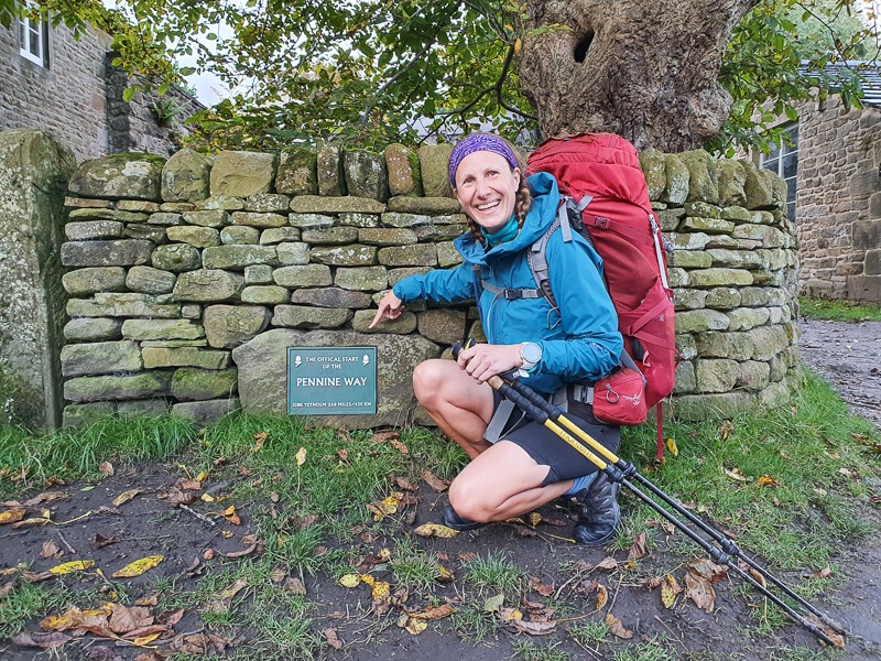
From Edale and the Nags Head pub (the official start point), the trail is well signposted for the initial stages taking you across fields, through Upper Booth Farm and along a good track to the bottom of Jacob’s Ladder. It’s a good gradual start, warming those legs up ready for the first steep climb up Jacob’s Ladder and beyond to Edale Rocks and Kinder Low trig point.

Once you’ve reached Kinder Low trig point it’s on to Kinder Downfall, the path can appear and disappear along this section but keep to the edge until you reach Kinder Downfall and you can’t go too wrong, even though in bad weather it can feel dis-orientating.
Next, you head down along the Pennine Way trail towards Snake Pass via a long section of flagstones. Great as you won’t get lost and saves walking in the surrounding bog but the repetitive motion can cause your feet and body to ache in places you weren’t expecting.

Once over the road, there are a few more flagstones, before the path becomes rocks and winds through the cloughs alongside the streams trickling down the hill. Although not overly technical, the winding path can feel disorientating as you can’t see the scenery around you. There are several places you’ll need to cross the water as the path again disappear and reappears throughout the section.
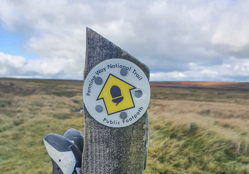
Look out for stones with Pennine Way signs which give you the confidence you’re on the right track! On to Bleaklow, the second-largest summit in the Peak District marked with a large cairn then continue until the path takes you out of the clough and along the edge now gradually descending.

You’ll spot Torside Reservoir in the distance and follow the path down to a farm, turn left along the track then across the road and over the reservoir path (*see note below), across the road, through the woods and along the track to where you turn left to head away from civilisation.
Detailed route description + online map of the route
*Important note – The path across Torside Reservoir is currently closed (has been for months) which means you’ll need to divert around the Rhodeswood Reservoir adding 1.5 m/2.4 km to the route. (If you go round Torside Reservoir it’s 1.7 m/2.7 km).
Places to eat/shop
Starting from Edale there is a small general store in the village. There are two lovely hiker-friending pubs – The Ramblers Inn and The Nags Head and also two cafes – The Penny Pot Cafe and Newfold Cafe.
There are no places to eat or food supply options in Crowden. (There was the campsite shop but as mentioned below this is closed until 2021).
Public toilets – at the start in Edale (village car park)
Where to stay
Edale accommodation
Since most people want to start early in the morning for day 1 on the Pennine Way it’s worth arranging accommodation for the night before the walk to save on losing valuable hiking hours. The only wild camping options are on high ground.

*Fieldhead campsite – a lovely campsite in the centre of the village, I’ve stayed here many times
Edale YHA – a great budget hostel, although you’d add 1.4 m/2.3 km to your walk as it’s further away
Airbnb options – there are numerous Airbnb options in Edale
Crowden accommodation
Currently, Crowden Campsite* I used on my first Pennine Way hike is closed until 2021, which leaves the only options for accommodation further out, unless you choose to wild camp.
Airbnb options – the only Airbnb accommodation is at Glossop
Booking.com options – Windy Harbour Farm House (previous offered pick up/drop off) or more options here
*Please check whether campsites are still open – some close from October + some are currently closed due to Covid-19
Day 2 – Crowden to Standedge
Distance: 11 miles/17.7 km
Total ascent: 828 m
Highest point: 582 m (Black Hill trig point)
Summary + highlights
Depending on where you ended up staying the previous night, in theory, this should be a shorter route today. It’s another fairly remote section of the trail and depending on the weather the water crossings can be tricky on this section so prepare for wet feet!

The section up to Black Hill and beyond is mostly a flagstoned path, again great for navigating but can be tough on your feet. After crossing the road it’s away from civilisation on another short but remote section to Standedge.
The highlights include Laddow Rocks and views down the valley, Black Hill and numerous waterfalls alongside the reservoirs.

The route
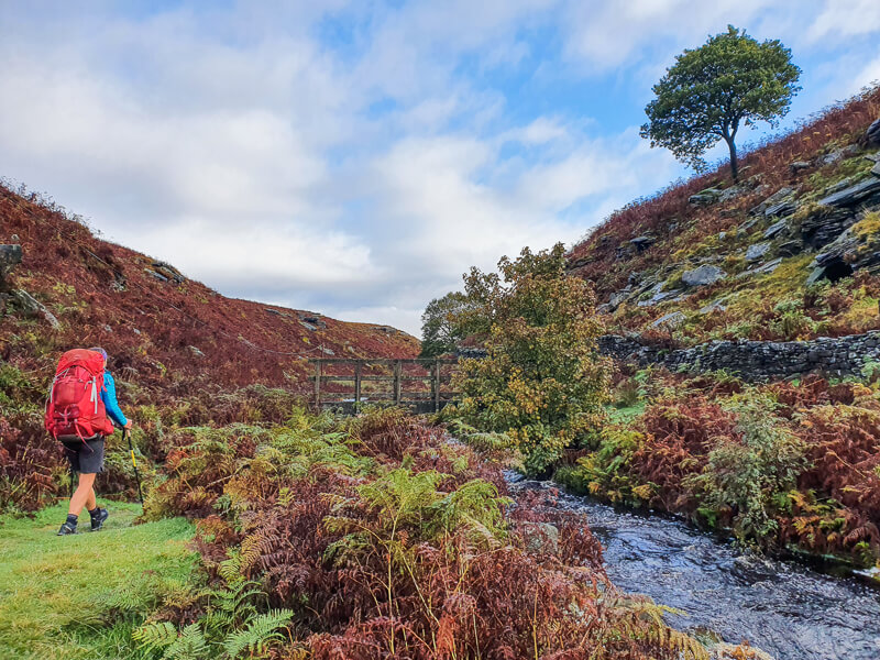
From Crowden, you start gradually on a rocky path but it’s soon a short but steepish uphill section to Laddow Rocks and walking along the edge at the top. The path continues but now heading down to a few water crossings, simple on sunny days but rainy days can mean a trickier crossing!
Once you’ve navigated through these, there are flagstones leading up to Black Hill trig point and then down the other side as the trail winds across the moorlands to the road. It’s a short walk up the road to the next Pennine Way signpost then along a good track past the reservoirs.

Be sure to look for the left turning off the track for the final section of the day which takes you across a bridge and up a steep path to higher ground, with great views looking back down the valley. There are more reservoirs until you reach a small car park and the road at Standedge.
Places to eat/shop
There’s literally nothing on the Pennine Way trail when you reach Standedge. The options are to detour to either Diggle or Marsden unless you’re wild camping.
Diggle has limited shops, newsagents but mainly a couple of pubs and a chippie (which closes early).
Marsden has better options with a Co-op and also pubs where you can get food.
Public toilets – none on route
Where to stay
As per above, there’s no accommodation to stay at Standedge. If you are camping then you have the option to wild camp, there are a few options on this section. Read the section on Wild Camping below.
Campsites – none available
Booking.com accommodation – Diggle (3 options) or Marsden (5 options)
Day 3 – Standedge to near Hebden Bridge
Distance: 14.5 miles/23.4 km
Total ascent: 339 m
Highest point: 472 m (Blackstone Edge trig point)
Summary + highlights
A longer day on the trail to finish near Hebden Bridge, however, there’s much less ascent on today’s route so you can enjoy an easier day (sort of!) The beginning of the day can be exposed as you remain high for most of the day.

It’s a day of trig points, ticking off three in close succession on the first half of the day. Then a highlight for me was crossing the M62, the highest point on the motorway (and highest in England). Before reaching an iconic Pennine Way highlight – Stoodley Pike Monument, you can see it in the distance but it’s not until you’re up close that you realise how big it is!
The route
The Pennine Way continues out of the Peak District National Park and across the road following the Pennine Way signposts. Be sure not to turn off onto the Pennine Bridleway which intersects the route. Then it’s through a gate first along the Millstone Edge to the trig point with views across to Manchester.

Then it’s on to White Hill before crossing over the motorway bridge over the M62 and uphill through heathery moorlands to Blackstone Edge trig point. From there it’s down to the road then another section past a couple more reservoirs along a good flat track and not long after you see the first glimpse of Stoodley Pike.
The final part of the day then takes you downhill to where the Pennine Way crosses the A646 road, although many hikers opt to divert into the lovely town of Hebden Bridge, full of shops, cute cages and more importantly, places to stay!

Places to eat/shop
Shortly after you cross the M62 and the White House pub, please note the opening hours are limited (12-2 pm). We arrived too early but were able to sit outside on their benches. (Thank you).

Where the Pennine Way crosses the road near Hebden Bridge there isn’t anything. However, 2.5 km down the road, Hebden Bridge has almost everything you need, including a Co-op for resupplying food.
There are also plenty of lovely cafes, pubs and restaurants where you can treat yourself to some delicious food.
Public toilets – none on route
Where to stay
At Hebden Bridge, you are really spoilt for choice for places to stay
Campsites* – there are again many to choose from including Old Chamber Farm + Camping and Hebden Bridge Camping
Booking.com accommodation – Hebden Bridge (36 options)
Airbnb options in Hebden Bridge (there are loads!)
*Please check whether campsites are still open – some close from October + some are currently closed due to Covid-19
Day 4 – Hebden Bridge to Cowling
Distance: 15.5 miles/25 km
Total ascent: 893 m
Highest point: 450 m (near Top Withins)
Summary + highlights
Leaving Hebden Bridge the route starts with a steep ascent, a tough start. But the views back to Stoodley Pike are wonderful. The day is mixed with moorlands, where you’ll find boggy sections but also plenty more reservoirs.
One of the highlights is Top Withins, old farmhouse, plenty of history to read about here as it’s linked to the book ‘Wuthering Heights’ and even a bothy for shelter if the weather is bad. From here the route is similar with a mix of reservoirs and moorlands until you reach the end of the day.
The route
From Hebden Bridge, it’s an incredibly steep start to the day, fortunately, I’d done it the night before as we’d wild camped up high but if you’re staying in Hebden Bridge the steps go up and up!
You make your way across remote moorlands, some flagstoned sections (but not all). Then over a couple of cute wooden bridges crossing Graining Water and on to another reservoir, there are more than you realise on the Pennine Way! The route then continues via some more flagstones sections to Top Withins, a perfect place to stop for a break or lunch.

From here it’s down to more reservoirs and a small section through a village. Then it’s uphill and away from the reservoir, across a road then over a particularly boggy section for most of the route to near Cowling. The Pennine Way route for this day finishes at the road where you can opt for Ickornshaw or Cowling to rest.
Places to eat/shop
Top Withins Bothy is a good shelter for your lunch stop if the weather is bad. But there are no other food shops on the route until you reach Cowling.

In Cowling, there’s a small corner shop and takeaway. However, there’s also an Indian (I had on my 2019 trip, which was yummy) and this time I had takeaway pizza.
Top tip – Order a large pizza and save some for lunch the next day!
Public toilets – none on route
Where to stay
Squirrel Lodge Campsite – camping, bunk barn or lodges available. Plus a cool Shepherd’s Hut too! – Highly recommend here, I stayed in the bunk barn when I did Pennine Way the first time and it’s brilliant
Cowling Airbnb – this is where we stayed on my recent trip. A flat with a double bedroom, lounge, kitchen and bathroom – perfect to relax for the night.
*Please check whether campsites are still open – some close from October + some are currently closed due to Covid-19

Day 5 – Cowling to Malham
Distance: 17 miles/27.4 km
Total ascent: 696 m
Highest point: 388 m (Pinhaw Beacon trig point)
Summary + highlights
The trail today starts with a few gentle inclines, then up to the highest point for the day, Pinhaw Beacon. After here you then have a relatively flat ish hike, as most of the ascent for the walk is done.
A big highlight for me on this section was walking past a Goat Sanctuary, pop and say hi if you have time, you can even feed the goats for £1!

Then another highlight is along the canal path where you’ll come across the unusual double bridge. A few miles later, it’s through Gargrave visit and if you go anywhere be sure to visit the Tea Rooms AND Sweet Shop.
The last part of the day is mostly across fields until you get closer to Malham and in the distance, you’ll be able to spot Malham Cove – a real treat for the last day.

The route
From Cowling, it’s down the road to pick up the Pennine Way, across various fields with plenty of gates and stiles. The route takes you across a couple of roads, and downhill to Lothersdale, where you’ll spot a tall chimney. Go through the village, across a few more fields/gates then it on to an open moorland section ascending to Pinhaw Beacon and then down again.

Once you reach the road this is where the Goat Sanctuary is, you walk straight past it, near Thorton-in-Craven, before down a few country lanes then you pop out on the canal towpath for a short section. You go under the double arched bridge and shortly after you are back hiking across fields.
The fields seem to go on for a while, each one looking similar to the next before eventually you near Gargrave village. Once you leave the village you then walk through numerous fields over the undulating ground until you follow the river and then head up over a hill to see Malham up ahead.

Places to eat/shop
East Marton – you can come off the trail a short distance to a great pub called The Cross Keys (great food)
Gargrave – Co-op and also a lovely Tea Rooms and sweet shop
Malham – pubs (Buck Inn or Lister Arms) as well The Old Barn Cafe
Public toilets – Gargrave (18 km into the walk) and Malham at end of the day near Visitor Centre

Where to stay
YHA Malham – camping, cabins or rooms available (no dorms available at the moment)
Malham luxury camping pod
Airbnb options in Malham
*Please check whether campsites are still open – some close from October + some are currently closed due to Covid-19
Day 6 – Malham to Horton-in-Ribblesdale
Distance: 14.4 miles/23.2 km
Total ascent: 894 m
Highest point: 694 m (Pen-y-ghent trig point)
Summary + highlights
The last day of this 6-day Pennine Way adventure, unless you’re tempted to keep walking to the Scottish Borders! The day begins with Malham Cove and hiking up to the limestone pavement, where you have amazing views from the top of Malham Cove and rolling hills. You continue heading past Malham Tarn and through the woods nearby.

Then an uphill section via Fountains Fell, from this viewpoint you can see all three Yorkshire Three Peaks! It’s another descent then finally back uphill to the summit of Pen-y-ghent before descending into the village of Horton-in-Ribblesdale to celebrate stage 1 of the Pennine Way.
The route
You walk through the streets of Malham before turning right to head to Malham Cove, follow the track and then up the steps to the left taking you to the top. The path goes around the back but it’s worth taking your time to explore the limestone pavement and views from the top.

You take the path down, then turn left away from the main Malham walking circular past more limestone rock formations then heading down towards Malham Tarn. The path goes around the right-hand-side of the tarn then bears left heading past a few buildings and woodlands, where you’ll spot several wooden carvings.

From here, it’s across fields then begin a gradual uphill climb to Fountains Fell cairn, it’s a rocky descent down to the road and along for a short distance before heading up to Pen-y-ghent via a track then a short scramble section to the summit and trig point!

At the top, you descend via flagstones on a winding route around the back of the hill, before turning left down a track into Horton-in-Ribblesdale. If you turn left at the road you end up at a very nice pub!
Places to eat/shop
There are no shops on the route, but a couple of lovely pubs when you reach Horton-in-Ribblesdale – The Golden Lion is my favourite, although The Crown Hotel is great too!
Public toilets – the start of the day in Malham car park
Near Malham Tarn (these were closed on this trip)
Where to stay
Please note accommodation for the weekend is popular due to the Yorkshire Three Peaks Challenge starting in Horton-in-Ribblesdale.
Airbnb options in Horton-in-Ribblesdale
*Please check whether campsites are still open – some close from October + some are currently closed due to Covid-19
Pennine Way (Part 1) – Useful information + questions
Pennine Way maps and GPX files
If you would like to do this route, you can get an email with this post, plus all the links to the online maps and GPX files. Pop your details below and you’ll get everything straight to your inbox so you can refer back when planning your trip!
How do you get to the start and end of this section?
One of the reasons I decided this 6-day Pennine Way trail would make a great long-distance trail is the public transport options at the start and end of the route.
Trains run regularly from both Edale and Horton-in-Ribblesdale. The trains from Horton-in-Ribblesdale stop running after 5.30 pm. They are also less frequent on a Sunday. Check times here via National Rail journey planner.
On the route, there are several options for public transport if you need to shorten the walk, for example, if you get injured. There are train stations at Marsden, Hebden Bridge, Gargrave and Settle.
When is the best time to hike the route?
As a shorter section of the Pennine Way full trail you can hike it at any time of year, but here are a few things to consider when planning your adventure. I initially hiked the trail in June and this trip was in October.
The peak season for hiking the trail, similar to most national trails in the UK is between end of June to August. If you choose one of these months, the trail will be busier and if you’re booking accommodation then you’ll need to organise sooner to make sure those places with fewer options don’t fill up ie near Crowden and Cowling.
Hiking in the trail in May, early June or September can be quieter and also may be cooler weather, but you never know in the UK. April is also cooler but you can clash with the Easter holidays which are busy.
Then there’s October, quieter on the trail but cooler in temperature, something to consider if you’re camping. You read my tips here for keeping warm when camping in winter.

Midges
If you are camping and want to avoid the midges which seem to be around for longer then try to avoid the warmer months from July onwards. Although, we had some in October, no idea how they had still survived.
What day to start the hike?
One thing I hadn’t considered both times I did the trail, the first time because I was hiking the Pennine Way as part of a longer walk – my #E2WChallenge and the second time joining a friend’s challenge, but it did get me thinking about what is the best day to start.
The main pressure points on the trail where ideally you don’t want to be clashing are at the weekends. It’s busier on the trail especially in Edale, Malham and Horton-in-Ribblesdale, also you might struggle with accommodation in these places.

Both times I’ve started on a Monday, missing the weekend hikers in Edale and having a lovely start to the hike. But this means the Malham to Horton-in-Ribblesdale section falls on a Saturday. Malham is a popular place to visit, although if you start hiking earlier you’ll miss most of the main crowds. However, as soon as you reach the final part of the hike up Pen-y-Ghent you’ll catch up with the Yorkshire Three Peaks hikers, no real issue but it can mean accommodation is difficult to find and will be busy.
The other thing to consider is public transport, the trains from Horton-in-Ribblesdale stop running after 5.30 pm so you either need to make sure you’re there or book accommodation for the night. They are also less frequent on a Sunday.
Can you wild camp on the Pennine Way?
The Pennine Way is a remote trail, however, it does still go through plenty of small towns and villages on the route. If you’re planning on wild camping then you’d need to look for the options on Open Access land, away from private land and houses. Ideally, the higher up the better, but of course, it depends on the weather conditions.

We wild camped on the trip near Crowden, Standedge and near Hebden Bridge. The wild camping options seemed limited around Ickornshaw/Cowling so we treated ourselves and stayed at an Airbnb.
On the route, I was looking out for wild camping spots and did see quite a few options for each day so they are available.
Read my beginner’s guide to wild camping here.
Do you have to carry all your own food?
There are two options for this trip, option one is to eat at cafes, restaurants and pubs on the route, which I’ve noted under each section.
If you’re opting for more of a budget style trip or prefer cooking for yourself the options for food shops is limited. There are no food shops in Edale so you need to come prepared with supplies. If you’re staying overnight you could treat yourself to a pub meal before you set off.
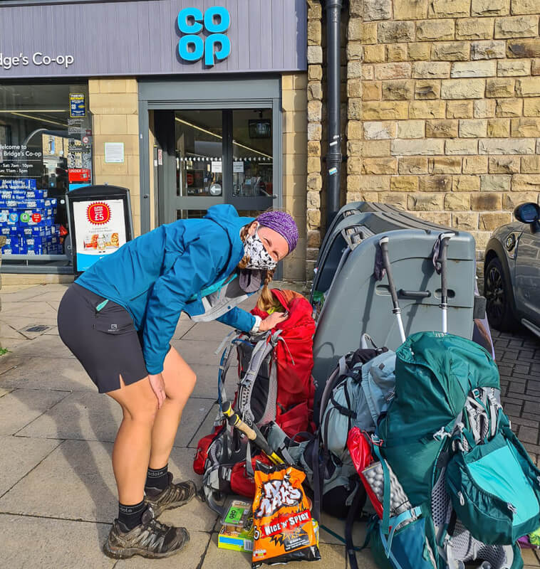
The next food shop on the route is at Hebden Bridge, slightly off route but an easy detour down to this lovely town. After here the next shop is at Gargrave which is almost exactly on the route.
If you go with these two food resupply options, here’s approximately what you need to take/carry. At Hebden Bridge, you can get your dinner for the night and at Gargrave, you can get lunch (although it’s about 18 km into the day so worth having some snacks to keep you going).
- Edale to Hebden Bridge (3 days food – B x 2, L x 3, D x 2)
- Hebden Bridge to Gargrave (2 days food – B x 2, L x 2, D x 2)
- Gargrave to Horton-in-Ribblesdale ( 1.5 days food – B x 1, L x 1, D x 2)
*(B – Breakfast, L – Lunch, D – Dinner)
This is based on no treats or stops at cafes, restaurants or pubs on the route.
What kit should you take?
This will depend on whether you’re camping or staying in accommodation on your trip. But either way the lighter your backpack the more enjoyable your trip will be and the less chance of injury, even those dreaded blisters!
For a full camping kit list, you can check out what I took on my 2-month long-distance hike here. With the exception of taking my winter sleeping bag and mat on this trip, it’s pretty similar.
I would say essentials for a Pennine Way trip are good waterproofs, you never know what the weather will throw at you and being warm and dry is another thing that will affect your mood and happiness on this hike!
I hope that answers all your questions about doing this long-distance challenge. If you have any more questions then ask me in the comments below.
More adventure ideas?
If you love the idea of trying out a long-distance hike or a challenge you can check out my guide with 18 different long-distance walks and challenges in the UK here.
18 BEST Long-Distance Walks in the UK (+ Tough Challenges)
And if you want to read more on the hikes and challenges I’ve done both in the UK and abroad, I have a brand new Adventure + Challenge page on my website.
I created this page partly for me but also as a useful tool for you to use! You’ll find more detailed guides on my challenges I’ve done in the last few years (when I’ve had my website), but you can also read about other things I’ve done and ask me any questions about those too.
Save this post to your UK adventure board on Pinterest


*Becky the Traveller participates in the Amazon Services Associates Programme, as well as other affiliate programmes. If you make a purchase through these, I earn from the qualifying links. This is at no extra cost to you. Read more here.
Thank you for the info’s. Thinking of hiking it by myself but concerned its very remote and quiet, I’d feel safer if you see other hikers every now and then. How busy is the hike? Can you go for hours without seeing anyone or is it fairly well used? Thank you x
Hi please can you send me the gpx route for this project walk, thanks
Hi, sorry I don’t have the GPX for this route. If you search for my full Pennine Way guide the GPX is saved in that one, but for the full route, not just this section 🙂