
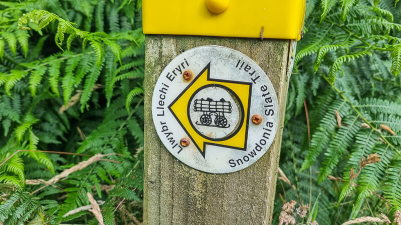
In July, I hiked the Snowdonia Slate Trail – Llwybr Llechi Eryri in north Wales. It’s a beautiful long-distance hike which had been on my list for some time.
In traditional ‘Becky’ style I opted to wild camp on my trip, allowing me flexibility to hike longer distances each day and take advantage of the longer days during the summer month of July. Keep reading to find out more about wild camping on the trail, but don’t worry, I will include options for other accommodation too.
Here I’ll share my Snowdonia Slate Trail – Llwybr Llechi Eryri itinerary, I’ll also include food shops for resupply, pubs and cafes, toilets on the trail as well as the many highlights that you can enjoy each day which hiking this wonderful walk.
Is the Snowdonia Slate Trail – Llwybr Llechi Eryri on your list?
If you have any other questions please message via Instagram @beckythetraveller or pop a comment below.
Snowdonia Slate Trail – Llwybr Llechi Eryri Walk

About the Snowdonia Slate Trail – Llwybr Llechi Eryri
The Snowdonia Slate Trail – Llwybr Llechi Eryri is what I’d class as a shorter long-distance trail, at under 100 miles it’s perfect if you want to tackle your first long-distance hike. The total trail is 83 miles/133 km long. The official start is in Bangor, it’s a linear walk, approximately 10 km to Bethesda and from there it’s a circular loop.
You’ll see from my itinerary I made a few tweaks to my hike, partly because of convenience but also I had plans on the Sunday so I only had a 4 day window to complete the trail.
The route has some days with big ascent but since the trail skirts around the big hills and mountains of Snowdonia, it means you can enjoy the mountains from a distance without having to summit any of them!
As someone who loves hiking up the big hills this trail made a refreshing change and I relished in seeing the mountains from different angles as I walked the trail. The route takes you through all the small villages around the slate mines, hence the name of the Snowdonia Slate Trail – Llwybr Llechi Eryri. And of course, you walk though several disused slate mines and the ruined mining buildings on the trail.
There’s certainly a good mix of scenery on the trail from rocky mountains and lakes, of course, there are numerous quarries, but there’s plenty of open moorland, beautiful woodlands and river sections. It’s a stunning trail. Have I convinced you yet? Keep reading!
Snowdonia Slate Trail – Llwybr Llechi Eryri map

Snowdonia Slate Trail – Llwybr Llechi Eryri GPX
Please find below my Snowdonia Slate Trail GPX. Click here for GPX file
How many days does it take to complete?
As with any long distance trail the number of days to complete it down to you. It firstly depends on what accommodation you’re planning to stay in, for example, B&Bs or guesthouses mean you’d need to stop at certain points or if you’re camping in campsites or wild camping again you need to research options.
I often wild camp on my long-distance trials, mixed in with a few campsites this allows me flexibility for my style of hiking. I also factor in the number of miles/km that I want to hike each day. Here’s a rough breakdown for this trail, based on distance (another thing to consider is your ascent) but I’ll include that later.
- 8 days = 10.3 miles/16.5 km per day
- 7 days = 11.8 miles/19 km per day
- 6 days = 13.8 miles/22.2 km per day
- 5 days = 16.6 miles/26.7 km per day
- 4 days = 20.1 miles/32.3 km per day
- 3 days = 27.7 miles/44.6 km per day
I’m comfortable hiking roughly 20+ miles km a day with approximately up to 1,000 metres of ascent which is why I settled on 4 days for hiking the trail.
If this is your first long-distance trail feel free to get in touch and I’ll help if I can 🙂 I’m also a qualified Mountain Leader so if you’re looking for a guide then please get in touch.
How much ascent is there?

Overall, according to the OS Mapping service the total ascent on the trail is 4,446 metres, with the highest point on the trail being 526 metres, which is close to Croesor Quarry, on the section of the trail between Croesor and Blaenau Ffestiniog. Then the second highest is not too far below at 508 metres, which is located near Blaen-y-cwn Quarry (disused).
As you can see from the ascent profile above the route does include some ascent each day but generally it’s nothing too challenging. My days included more ascent purely because I did longer distances each day.
My Snowdonia Slate Trail – Llwybr Llechi Eryri hike
My itinerary
I opted to hike the trail in 4 days and in addition, I also chose to begin my hike from a different start point, which also meant I didn’t include the first 10 km from Bangor to Bethesda. I’ve done enough trails now to be happy that I can make each trail my own. Some people will be 100% true to the trail without deviating but I like to do what’s right for me and I still enjoy the trail just as much.
I started my hike from Dolgam Campsite, approximately 700 m from the trail. I had a few reasons for this, firstly, I didn’t want to leave my van parked on the road for the duration I was away so a campsite felt a safer option. I happily paid the campsite £5 per day to park my van there, as well as staying the night before and after in the campsite. This location also suited where I needed to be on the Sunday to meet friends for a hike so I knew I could finish the hike then be in the right place for the next day.
- Day 1 – Dolgam Campsite via Capel Curig, Ogwen Valley and Bethesda to near Llanberis (39 km and 881 m) – Wild camp
- Day 2 – Via Waunfawr, Rhyd Ddu and Beddgelert to near Croesor (42 km and 737 m) – Wild camp
- Day 3 – Via Blaenau Ffestiniog and Llan Ffestiniog to near Llyn Morwynion (30 km and 1,129 m) – Wild camp
- Day 4 – Via Penmachno and Betws-y-coed to Dolgam Campsite (35 km and 759 m) – Wild camp
My total distance = 146 km*
My total ascent = 3,506 m*
*These numbers are based off my Strava stats, interestingly the distance works out more, even though I skipped 10 km of the route and the ascent shows as less; however I did have a few issues with my watch altitude so that may have caused the issue.
Day 1 – Dolgam Campsite to near Llanberis
Distance – 39 km
My day 1 started with a small ascent up from my campsite then walking through open access land towards Capel Curig, the views of the mountains surrounding the Ogwen Valley look stunning from this view especially Tryfan, one of my favourites. On this section you pass 2 campsites.

The route then takes you via Llyn Ogwen and Idwal Cottage where there’s a cafe, toilet and YHA with campsite too. If you’ve not visited here before and you you fancy a short detour a walk to Llyn Idwal is absolutely beautiful, approximately 1.5-2 km detour.
From here, it’s moving away from this popular spot and taking a 4 km road section heading alongside Pen yr Ole Wen mountain on your right and on to Penrhyn Slate Quarries where there are huge piles of slate alongside the route. The trail does a short loop into Bethesda, which is where you’ll pick up the trail if you’re starting from the official point at Bangor.
It’s a mix of road and off road until you reach Llanberis (roughly another 4-5 km road sections). The wooded area down to Llanberis is beautiful and it brings you out near the train station and slate museum.
Detour options – Add on Llyn Idwal
Day 2 – Llanberis to near Croesor
Distance – 42 km
After leaving Llanberis you ascend and are walking through a large area of disused quarries, then a short road section (approx 2 km) into and out of Waunfawr. In the height of summer this section was challenging due to overgrown bracken but hopefully, this has now been pruned! After here there’s a large area of quarries, with small buildings dotted about before heading into Nantlle. As you walk through this section you have a stunning view of the mountains known as the Nantlle Ridge, which is a wonderful high level route to walk (maybe on another day!)
The trail takes the scenic routes into Rhyd Ddu, which is totally worth it, then the views continue as you head on the trail all the way to Beddgelert. This is a beautiful little village, definitely worth stopping for refreshments here at one of the many places.
From Beddgelert, the trail heads alongside the river, called the Pass of Aberglaslyn, interestingly the OS map keeps you on the east side of the river, whereas the signposts direct you to stay on the west side. I walked the east side and really enjoyed it, the terrain was rocky and had a few mini challenges. If you prefer an easier option then stick to the signposts and follow the west path. This path was up there with my favourite sections on the hike.

You reach Nantmor, then there’s a 2 km road section before you’re on Open Access Land again, this was my wild camping area and I did struggle as there was loads of thick bracken and heather, but I looked high and found a spot!
Day 3 – Via Blaenau Ffestiniog to near Llyn Morwynion
Distance – 30 km
From Croesor, the trail begins the sections with the most ascent, the trail takes you on a path parallel to the mountain Cnicht which looks impressive from most angles and is known as the Welsh Matterhorn! After a tough continuous climb the trail brings you out at the first of two quarries Croesor Quarry, which is well established but then you’re in for a treat at Rhosydd Quarry which is by far the larger of the two.

It’s then all the way downhill until you reach Tanygrisau, where there’s a perfectly placed cafe so you can stop for snacks and a break. Continuing on the Snowdonia Slate Trail goes via two mining villages Blaenau Ffestiniog and Llan Ffestiniog, Blaenau Ffestiniog is the largest of the two, with more shops and places to eat but Llan Ffestiniog is a lovely quaint village and I recommend stopping at the playground with an ice-cream to see the best view of the trail!
The next section of the Snowdonia Slate Trail – Llwybr Llechi Eryri came as a huge surprise as I wasn’t expecting it to feel so different and magical. Ceunant Cynfal Nature Reserve is only a small part of the trail but it packs a lot into it, waterfalls, the most amount of green cascading down rocky cliffs and water trickling its way through. For me, this was a massive highlight and I felt like I was abroad in the jungle instead of Wales.
From here, the highlights kept coming as the trail goes via Access Land near Y Garnedd, the remoteness combined with surrounding hills, reservoir and mountains in the distance was spectacular and this ended up being my favourite wild camp spot on the trail.

Day 4 – Via Betws-y-coed to Dolgam Campsite
Distance – 35 km
My final day on the trail began with thick cloud and heavy rain, however I was glad to have seen the views the night before. The route continues through a remote section and numerous quarries before heading down to Penmachno, where there’s a small Londis and public toilets, a bonus on any rainy day walk!
Eventually you reach the cafe at Conwy Falls where you can take a short detour. The trail to this section does take you on a horrible 1 km road section, not much you can do except walk fast, but from here it’s all off road into Betws-y-coed where there are loads of places to resupply or stop for food. My favourite is the Hanging Pizzeria, another must visit place to get the calories in!

From Betws-y-coed, the river section is another stunning part of the trail and from there leads towards Capel Curing, at this point you’d continue towards Bethesda at the end of the trail (detailed in day 1) but I stopped here and returned to my van at the campsite for a rest.
Food (and water) stops on the trail
Water on the Snowdonia Slate Trail
I carried two Salomon soft flasks (500 ml each), plus a 1-litre Platypus bladder, so I had a maximum of 2-litres water. In hindsight, I would have carried another 2-litre bladder due to the warm weather to allow me options for more water, especially for my wild camp spots.
For previous long-distance trails, I aim to carry minimal water but regularly use my water filter from mountain streams on the trail and I’m always researching where the next water source is or maybe a village where I can buy or fill up from tap water. Due to the nature of this trail that I came across less natural water sources on the trail but I planned ahead and didn’t have any issues.
At one point, it was a warm day and I was a little concerned about my next water fill up so I knocked on a house (in the middle of no-where) and they kindly filled all my water bottles.
I use the Platypus Quickdraw water filter for my long-distance hikes.
Food shops on route
If you need to stock up on food supplies these are the general stores on route. Please note that these were in the east section of the trail.

*Distances are from Bangor (the official start point)
- Londis (Bethesda) – 10 km
- One Stop + Spar* (largest) (Llanberis) – 22 km
- Shop* (Waunfawr) – 29 km
- Emrys House* (Beddgelert) – 55 km
- Londis, McColls + Coop (largest) (Blaenau Ffestiniog) – 72 km
- Pen y Bryn Stores* (Llan Ffestiniog) – 78 km
- Londis* (Penmachno) – 99 km
- Londis + Spar (this has delicious homemade pasties + cakes) (Betws-y-coed) – 107 km
*These are the places I stopped to resupply (or mainly buy treats :))
Cafes/restaurants and pub stops
When I’m wild camping on my trip I like to try and support small and independent businesses on the trails by buying food and meals from shops, cafes and pubs on the trail. It doesn’t always work out since some places aren’t open when I’m hiking past them but I do my best!
*Distances are from Bangor (the official start point)
- Bethesda pubs – 10 km
- Llanberis pub* – 22 km
- Pub (Waunfawr) – 29 km
- Cwellyn Arms* and Ty Mawr B&B and Tea Room (Rhyd Ddu) – 46 km
- Prince Llewelyn pub (Beddgelert) – 55 km
- Cafe Croesor (Croesor) – 12-6 pm – 62 km
- Cafe* (Tanygrisiau) – 69 km
- Queens Hotel pub, Fish and Chip Shop – (Blaenau Ffestiniog) – 72 km
- Y Pengwern (Llan Ffestiniog) – 78 km (check opening hours beforehand latest is 6 pm)
- The Eagles pub (Penmachno) – 99 km
- Hanging Pizzeria, Royal Oak pub, Fish and chip shop (Betws-y-coed) 107 km
- Cafe (card only) (Ogwen Valley) – 125 km
*These are the places I stopped for food and/or drinks 🙂
Public toilets on route
*Distances are from Bangor (the official start point)
- Rhyd Ddu car park** – 46 km
- Beddgelert** – 55 km
- Penmachno – 99 km (20 pence – no change given)
- Betws-y-coed** – 107 km
- Capel Curig (30 pence – no change given) – 116 km
- Ogwen Valley visitor centre** – 125 km
**Public toilets are free of charge unless stated. Correct at time of writing.
Snowdonia Slate Trail – Llwybr Llechi Eryri – where to stay?
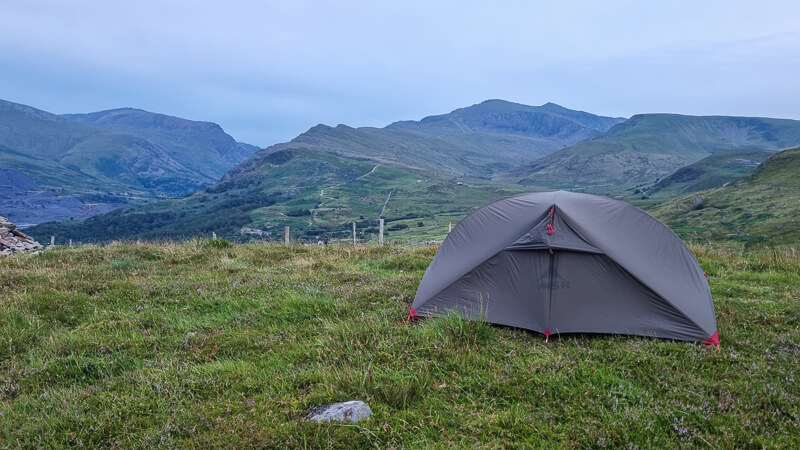
On my trip I started and ended at Dol-gam Campsite, located in between Betws-y-coed and Capel Curig. For the 3 nights on the trail I opted to wild camp at remote spots on the route.
Wild camping on the Snowdonia Slate Trail
The Snowdonia Slate Trail is a good route to wild camp on however you do need to plan your spots carefully as in some parts you’re too low or near villages which makes Wild Camping not suitable.
I personally opt for the highest group and select Open Access areas which means I’m not camping on private property and I adhere to the Wild Camping Guidelines:
- Leave no trace
- Arrive late, leave early
- Camp on Access land
- Away from paths and houses
If you’ve not wild camped before then you can read my detailed wild camping guide here.
The spots I selected were based on starting from Dol-gam Campsite so they may not work for your hike, depending on the distances you’re planning to do each day. My main challenges were the terrain as I often found myself in Open Access Land that was covered in thick bracken and heather which is not obvious from the OS map.
*Distances are from Bangor (the official start point)
- Night 1 – Outside of Llanberis near Cefn Du – 26 km
- Night 2 – Near Croesor – 61 km
- Night 3 – Craig y Carreg-lwyd – 86 km
Campsites on route
*Distances are from Bangor (the official start point)
Please note these are the campsites that I walked past that were directly on the route or saw signs for them, there are likely to be other campsites near the trail.
- Snowdonia Parc Campsite (Waunfawr) 29 km
- Talymignedd Campsite (near Rhyd Ddu) – 41 km
- Snowdon Base Camp/Cwellyn Arms (campsite, bunkhouse, rooms, cottages) – (Rhyd Ddu) – 46 km
- Beddgelert Campsite – 55 km
- Dolgam Campsite (Capel Curig off route) – 113 km
- Gwern Gof Isaf (near base of Tryfan) 121 km
- Gwern Gof (near base of Tryfan) 122 km
- YHA Idwal Cottage (hostel and campsite) 125 km
I didn’t research any other campsites but feel free to get in touch if you have stayed at one or own one and I’ll add it to the list.
Other accommodation on route
- Hostel (near Bethesda)
- Cwellyn Arms (campsite, bunkhouse, rooms, cottages) – (Rhyd Ddu) – 46 km
- Snowdonia Mountain Hostel (near Ogwen Valley) Tai Newyddion, LL57 3DQ
Wild camping kit list
Here’s the kit took for the Snowdonia Slate Trail walk. Pop any kit questions in the comments.
Backpack
I used an Salomon XA 35-litre backpack for this trip.
For additional protection from the rain Instead of a rain cover I use an Osprey pack liner and these ultralight Osprey dry sacks to keep my gear organised and easy to find.

Camping gear
Here’s my wild camp set up. I checked the weather beforehand and it looked like it would be cool at night but not dropping below zero which is why I opted for this kit.
- Summer tent – MSR Hubba NX (1.3 kg)
- Sleeping mat – Thermarest Uber-Lite – (250 g)
- Sleeping quilt – Thermarest Corus Quilt (Comfort level 0 degrees) – (560 g)
- Silk sleeping bag liner – Silk liner – (130 g)
- Pillow – Thermarest Air Head – (145 g)
Total weight of tent and sleep system = 2.5 kg
Read my review here on my MSR Hubba NX. It’s a brilliant lightweight tent for 3-season camping trips.
*I could have left my sleeping bag liner at home as the temperature was warm enough without it.

Cooking gear
- Cooking pot/mug
- MSR Pocket Rocket Deluxe
- Titanium Spork – 21 g
- Medium-sized gas – 385 g
- Swiss army knife – 119 g
- Lighter – 10 g
- Dishcloth
Cooking gear weight = 0.8 kg
Clothes + other kit

Hiking clothes + footwear
Here’s the kit I took/wore on my trip.
Footwear + waterproofs for my summer trip
- Hiking shoes – Salomon XA Pro 3D v8 (non-Goretex)
- Waterproof jacket – Salomon lightweight waterproof jacket
- Waterproof trousers – Salomon Bonatti
Hiking clothing for trip
For my long-distance hikes, I have one set of clothes for hiking and one for when I get to camp to sleep in.
- Salomon yellow vest (wear)
- Thin grey Salomon hoody (wear)
- Warm lightweight Salomon down jacket (for camp)
- Salomon Outline shorts (wear)
- Sports bra (wear)
- Decathlon running underwear x 3
- Socks x 3 (2 for hiking and a pair for camp)
- Thin beanie
- Buff
- Gloves
- T-shirt (camp/sleeping)
- Leggings (camp/sleeping)
Other hiking gear
- Leki hiking poles
- Watch + cable (Suunto 9)
- Water bottle x 2 – Salomon soft flask
- Hydration bladder with lid (Platypus)
- Water filter – (Platypus)
- Toilet kit – trowel, wipes, tissues, bag for rubbish – 277 g
- First aid kit – 239 g
- Head torch + cable – 97 g (LedLenser rechargeable torch)
- Compass (Expedition 4) – 38 g
- OS Map – OL17
- Foam sit mat
Other items
- Phone + cable
- Power bank (Anker 359 g)
- Toiletries – Toothbrush, toothpaste, hanky + lip balm
- Suncream (Premax), sunglasses + bug spray
The Anker power bank holds between 8+ charges for my phone and I also use for my watch as well. For the duration of this trip it was enough to charge my phone 1-2 times each day (I was using for photos and videos!) plus my watch.
Premax suncream, factor 50 is great for long-distance hikes, it’s non-greasy and comes in a 50 ml size. Check out and order here – Premax website.
Food for the hike
I kind of ran out of time when it came to food planning but I’d researched the first couple of shops and pubs so I knew I would be ok for food. Here’s what I ended up doing for food and meals:
- Day 1 – Lunch in Abergavenny. Carry own dinner (Wild camp)
- Day 2 – Carry own breakfast, lunch and dinner (Wild camp)
- Day 3 – Breakfast and buy lunch in Crickhowell and dinner at pub in Llangynidr (Star Bunkhouse) – Resupply extra snacks + 2 more lunches also at Crickhowell.
- Day 4 – Carry own breakfast, lunch and dinner (Wild camp)
In summary, the total food I needed to carry during entire trip was 5 breakfasts, 5 lunches, 4 dinners and snacks for the duration. I set off with 6 x breakfasts, 3 x lunches and 4 x dinners, plus snacks for 3-4 days. This meant I needed to do one resupply on the hike to buy extra lunches and snacks.
Here’s the food I took from the start.
- Peppermint tea bags x 3
- Coffee sachets x 3 (Raw Bean coffee)
- Porridge sachets x 4
- Freeze-dried meals x 3 (Firepot + Summit to Eat)
- Snack bars/breakfast bars x 10
- Tin of mackerel (emergency lunch)
- Mini cheddars x 6 (Aldi ones!)
Top tip – Base Camp Food have a range of different freeze-fried food, you can select different meals from their range including Summit to Eat, Firepot and Expedition Foods.
More questions about the Snowdonia Slate Trail
How much road walking is on the trail?
Due to the nature of the trail, the fact that it goes through lots of little villages on the way there is more road working than you might want or expect for a long distance trail. However, it did help in certain instances when I wanted to get a distance walked by a particular time.
I’ve broken it down by my 4 days to calculate the total road walking on this trail, which were all split into smaller sections, the longest road sections I did were about 4 km at a time, so roughly an hour of walking.

- Day 1 – 10 km (25% road)
- Day 2 – 4 km (10% road)
- Day 3 – 2-3 km (10% road)
- Day 4 – 2-3 km (10% road)
These are very rough calculations but overall the roads aren’t too busy, mostly they are single track roads with zero traffic, as mentioned the road section towards Conwy Falls was not pleasant but that was only 1 km out of the entire trail!
Overall, the Snowdonia Slate Trail – Llwybr Llechi Eryri is well signposted, I’d never 100% reply of signposts for navigating a trail but these certainly appeared at good points on the hike and did allow me to be lazy at certain points when navigating!
In addition, I carried the OS map – OL17 for Snowdonia, which I stupidly realised didn’t include the full route (the section from Croesor to Betws-y-coed is on the OL23 map for south Snowdonia).
Fortunately, I’d downloaded the full route via OS Maps, meaning I could use the full mapping of the route even when I had no signal and I also had the route on my Suunto watch using in navigation mode. I have used this combination on numerous long-distance trails previously and I find it works well.
Pop any questions below and let me know if you’re planning to do the Snowdonia Slate Trail walk too!
*Becky the Traveller participates in the Amazon Services Associates Programme, as well as other affiliate programmes. If you make a purchase through these, I earn from the qualifying links. This is at no extra cost to you. Read more here.
Excellent summary, and so much useful detail. Thanks. Hoping to do this route, with wild camping, this summer (2024). Best wishes
Ah enjoy the trail 🙂
Just finished the Snowdonia slate trail and found your blog so useful . Agree it’s such a stunning yet undiscovered route
Ah thanks Lisa, I’m so glad you found it useful. I loved the trail so it’s great to hear that you did too 🙂
I found your blog really useful when planning my own trip, especially for kit lists and tips. My son and I did the full route from Bangor in June 24 and spread it over 7 days. There are some truly stunning sections and most of it is so quiet as you’re walking the less well trodden parts of Snowdonia. As you say, Ceunant Cynfal is a hidden gem and we loved the wooded section before Llan Ffestiniog too (Coed Pengwern).
You’re right about planning ahead and I’d advise checking opening times for shops/pubs/cafes (don’t rely on Google – call them). The pub in Waunfawr for example doesn’t open on Monday or Tuesday and the cafe at Tanygrisiau closes at 4 but stops serving hot food at 3:30. There are some big gaps between facilities so you’re right to say plan to carry enough water and food.
– There are no facilities between Beddgelert and Tanygrisiau now the Croesor cafe has closed
– Llan Ffestiniog to Penmachno is probably the biggest gap
+1 for walking poles. There are some steepish sections and loose slate in the quarries can be very slippery when wet!
I was also glad I took gaiters, just for the section below Y Garnedd, which was boggy in places even in late June.
I’d also recommend Aled Owen’s guide to the Slate Trail. Aled does a fantastic job of maintaining signage and chivvying the councils to keep the trail clear and without his book you can easily miss some of the highlights of the walk.
Brilliant blog – keep it up Becky 🙂
Thanks so much Paddy, it sounds like you had a fantastic adventure and thanks for the updates on the closures I’ll be sure to update those. Wishing you many more wonderful adventures. Kind regards, Becky