
Dovedale is a beautiful part of the White Peak Area in the Peak District National Park and it is a great place to start a circular walk.
During the summer months, it is an incredibly popular place to visit but it’s also a perfect location to go for an autumnal walk.
If you don’t fancy a longer walk then you can read my shorter walk here. It’s another circular route, starting and finishing in Dovedale.
In this article, I will give you the route for the Dovedale circular walk that I did. Plus top tips and beautiful things to look out for on the way!
Planning on doing this Dovedale walk or any other Peak District walks?
Ask me any more questions in the comments below.
Dovedale Circular Walk
Walk Information
Start point: Narlows Car Park
Route: Circular walk
Walk distance: 10 miles/16 km
Walk time: 4-5 hours
Map: OL24 Peak District – White Peak Area
Dovedale Start Point + Facilities
Parking
Narlows Car Park: Spend Lane, Thorpe, Ashbourne, DE6 2AT
There are a couple of options for this walk depending on where you start. Since it’s a circular walk you can choose the one to start you!
I parked at Narlows car park, near The Old Dog pub. There is also a second car park further down the road from this one. Both of these are free car parks.
The third option is the car park directly on the Tissington Trail, there is a toilet and a small cafe here, selling hot drinks and snacks. This is a paid car park.
Toilet facilities on the walk
On the walk, there are a few toilet stops.
At Milldale, there’s a toilet and also another one at Tissington, directly on the Trail.
Other than these toilets there are very limited options on the first part of the route. The river is one side and woods the other (but the path is popular so you can’t really hide!)
There are a number of caves on the route, but these are NOT suitable as a toilet. Please be a responsible hiker and keep the walk beautiful for everyone.
Dovedale Walk Map

Dovedale Route
Stage 1 – Narlows Car Park to Thorpe Cloud
Distance: 1 mile/1.5 km
From Narlows car park turn right out of the car park, heading towards The Old Dog Pub along the road.
Continue past the pub, down the road, as you descend gradually on your right you’ll see the iconic hill Thorpe Cloud.
At the point where the road bends round to the left, you’ll see the entrance to the hotel. To the left of the drive, you’ll see a small fingerpost marking the way across a field around the back of the hotel.

Walk across the field then over another gate, continuing following the boundary wall to the left.
You’ll now see Thorpe Cloud hill in front of you, as long as it’s not too cloudy! In wet weather, the field can be very wet and boggy so waterproof hiking boots are recommended!
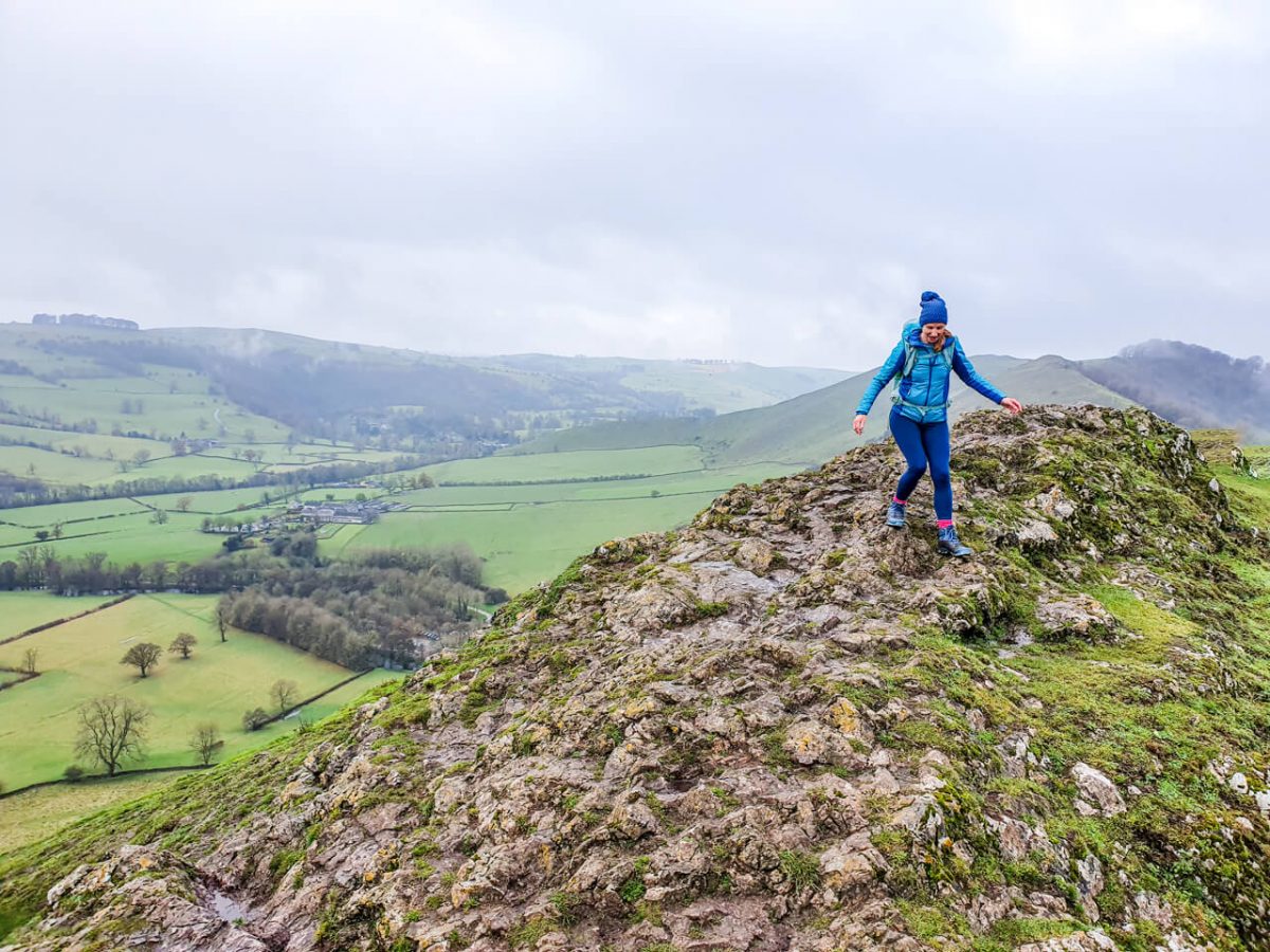
You then go through a gate then descend Thorpe Cloud up a steep path. In wet weather, the rocks can be very slippy at the top, so watch your footing!
At 287 metres high (924 ft), it’s one of the smallest hills in the Peak District but you have wonderful views from the top!
Stage 2 – Thorpe Cloud to Reynard’s Cave
Distance: 2 miles/3 km
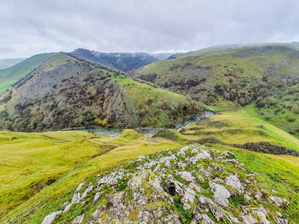
Enjoy the views from Thorpe Cloud, at the far end you can see all the way down to the River Dove. From this point, you can see numerous paths heading down.
However, due to erosion, these have all been re-routed to one main path which takes you down from Thorpe Cloud, heading away from the River Dove.
Read next Chee Dale stepping stones walk

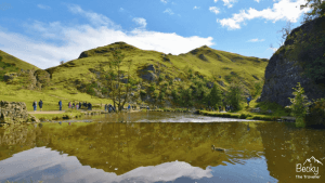
Walk along the base of the hill towards the River Dove. Once you reach the River Dove, you’ll see the popular Dovedale Stepping Stones. On a beautiful summer’s day, these are really popular, hopping across the river.
The autumnal day I did the walk, there had been heavy rain and the River Dove was flowing strongly, hiding the stepping stones under a torrent of water. The path was also flooded in some areas but still passable.
From the Dovedale stepping stones, turn right and go through the stone stile continuing along the path by the River Dove for about 1 km.
You’ll go up some steps, past Lover’s Leap and the Tissington Spires, huge rock formations on your left.

The path continues along the River Dove, through the woods. Be sure to look out for different wildflowers and mushrooms, depending on the season.
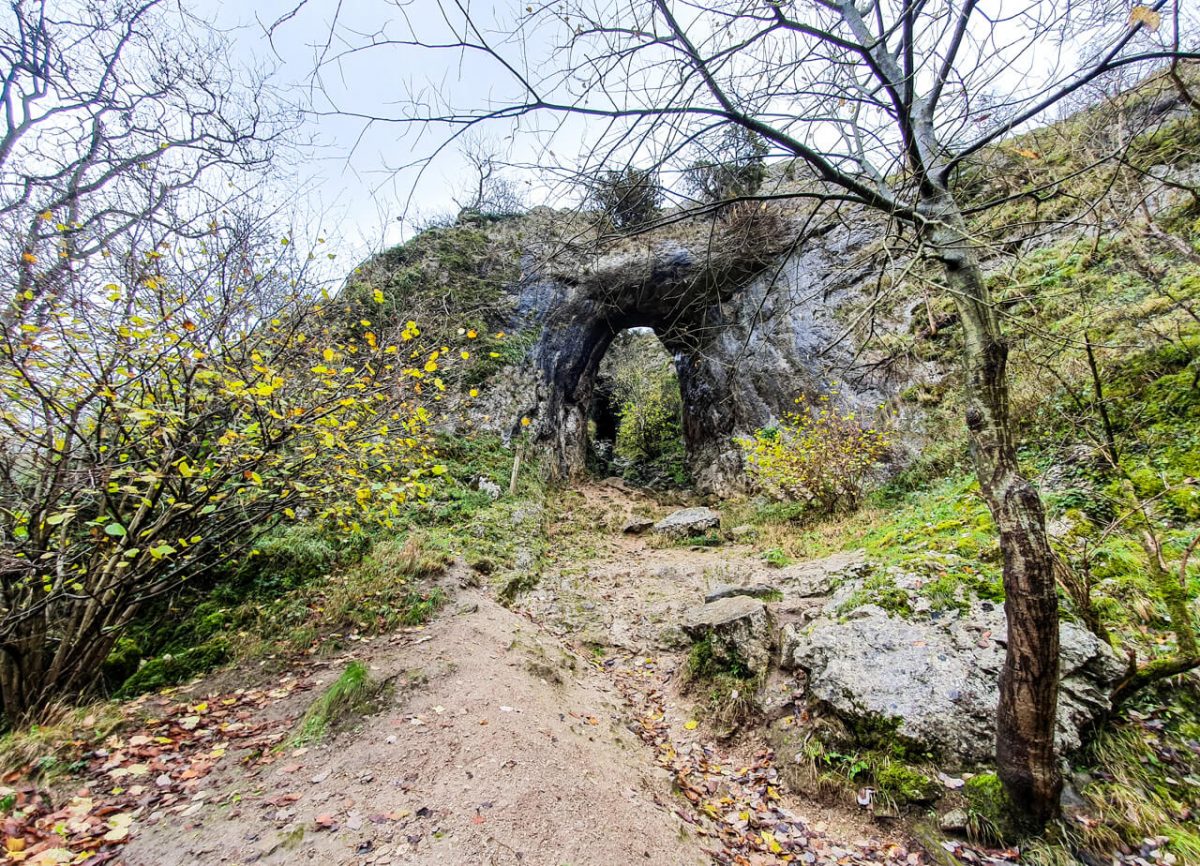
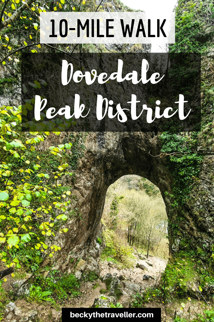
You’ll notice various trails heading off from the main path. After about 1 km, look out for a trail with a large boulder a short way up. If you look further you can see an archway, and before that is Reynard’s Cave.
Read next - Beautiful Chee Dale Walk in the Peak District
Stage 3 – Reynard’s Cave to Milldale
Distance: 2 miles/3 km
The path up to Reynard’s Cave is incredibly steep and rocky in some places. I hiked up to the cave on a wet day and some rocks were slippy. See what the weather is like when you do your walk so decide whether to hike this section.
From the cave keep walking along the path. You’ll go past some more awesome caves, called Dovedale Hole. Again these are great for exploring, or sheltering from the rain!
But be careful in wet weather because the rocks difficult to get a grip on.

From the caves keep walking on the path all the way to the small village of Milldale.
If you want to stop for a break, then cross the bridge. There’s a small shelter, information point and toilets here.
Stage 4 – Milldale to Tissington Trail
Distance: 2 miles/3 km
If you crossed the bridge to use the toilets, then make sure you cross back again!

Now head up the path right by the side of the bridge. It’s a steep uphill climb, best to take off a layer if you’ve got a warm jacket on!
Follow the footpath signs, keeping to the left of the boundary wall and going through several gates and stone stiles. After 1 km you’ll reach a crossroads with a wooden fingerpost.
Continue heading straight signposted towards Tissington.
Then another 1 km across several more fields you’ll reach a small road, on the left there’s a small stone stile, go through it and across the field, around a house. This area is pretty muddy!
Then follow the path, down to the main road, with the boundary wall on your left. For some reason, although this is marked as a footpath, the metal gate is locked! I climbed over, but if you’d rather not then you’ll need to detour slightly following the road and then doubling back.
Once across the main road, then continue down a smaller road, at the end turn left. In front of you, you’ll see the old railway bridge, leading you on to the Tissington Trail.

Stage 5 – Tissington Trail to Narlows Car Park
Distance: 3 miles/5 km
The last part of this walk takes you along the Tissington Trail, along a narrow trail, also shared with bicycles and horse riders. The Tissington Trail is an old train line in England, you’ll pass under many old railway bridges as well as going past the old train station at Tissington, now a small cafe and toilets!
Follow the Tissington Trail for 3 km, until you reach a second car park.
From here, turn left, walk up the short road and you’ll be back at the car park!
Dovedale Circular Walk – Top Tips
- Allow extra time for the first part of the walk. There are so many places to explore on the way
- If it rains a lot the paths can get flooded, I’d recommend wearing waterproof hiking boots
- The second part of the walk goes across fields and can be very muddy
- Once you reach the Tissington Trail, the map reading is easy, but don’t miss the turning back to the car park!
Dovedale Shorter Walk
Fancy a walk in Dovedale but don’t want to do a 10-mile walk?
Try my shorter circular walk option right here.
Dovedale Stepping Stones Walk (In The Beautiful Peak District)
Dovedale Stepping Stones walk is in the ‘White Peak Area‘, in the Peak District, Derbyshire. Unlike the ‘Dark Peak Area’, which includes steeper hills in Edale [...]
read hereDo you have any questions about this Dovedale walk?
Ask me any questions about the walk or any other ideas for walks in the Peak District in the comments below.
Save to your Hiking Boards on Pinterest


*Becky the Traveller participates in the Amazon Services Associates Programme, as well as other affiliate programmes. If you make a purchase through these, I earn from the qualifying links. This is at no extra cost to you. Read more here.
Thanks Becky, we’re doing the walk this very moment. Just resting now as we reach the rail trail, only 3 miles to go back to the Old Dog Pub. Spectacular weather today.
ah that’s lovely to hear Andrew, so glad you’ve had a great day 🙂
We are doing this to raise money for our charity auora ….so would like some information on it please and also if there is alot of steep hills
Hi Tracy, ah that’s fantastic to hear, I’d recommend you do a recce of the walk to ensure it’s right for your group. There are hills and ascent on the route, including Thorpe Cloud but it depends on your level of experience whether you’d find it a steep hill or not. Good luck on the challenge.
Pingback: 7 Cool Caves in the Peak District (You Can Visit For FREE) – Peak District Walks
Hi! I’d like to know if there’s any cow fields on this walk? Thank you 🙂
Hi, I’m sorry I’m not able to answer that, it’s been a while since I walked the route and farmers can move there stock between fields throughout the year so it’s something that can change.